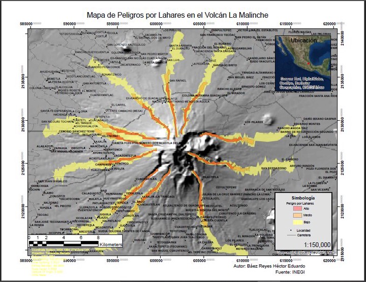
Lahars Hazard Map
 Map
Map
There are communities located on the slopes of the volcano that have a certain degree of vulnerability associated with geological phenomena.
Lahars are flows of water-saturated sediments that move down the slopes of a volcano. These flows are large in volume and pose risks to human settlements located near the volcano.
All the information was treated with Arcgis and a plugin called laharz, this plugin allows to simulate flows from the following data: digital elevation model, drainage pattern, slope map and data associated with the flow such as volume and saturation.
Héctor Báez
Geologist Engineer
My research focuses on spatial data analysis, GIS, and web development to share knowledge of geospatial data.