Biography
A multidisciplinary professional, graduated from “Universidad Nacional Autónoma de México” in Geological Engineering. Passionate about Geographic Information Systems and Geospatial Data Science.
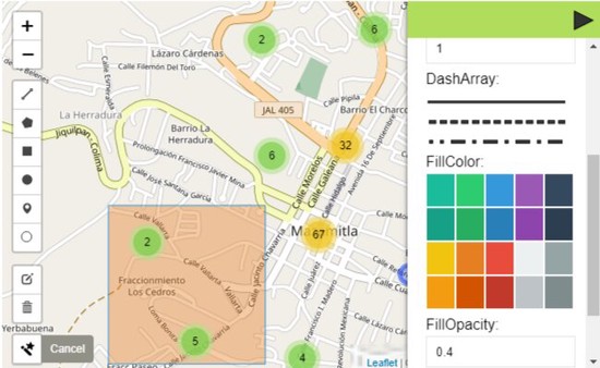
He has participated in projects related to GIS, Cartography, Geospatial Data Analysis, Civil Engineering and Public Transport. Currently working as a freelancer, developing GIS solutions and web development.
A self and fast learner person who likes to involve in new projects with new challenges. With core values like responsibility and honesty which rule his life.
Interests
- Geographic Information System
- Earth sciences
- Cartography
- Web App Development
- Web Maps
- Data Science
- Programming
Education
-
Web App Development, 2021
Michigan University (online course)
-
SQL Introduction, 2021
Michigan University (online course)
-
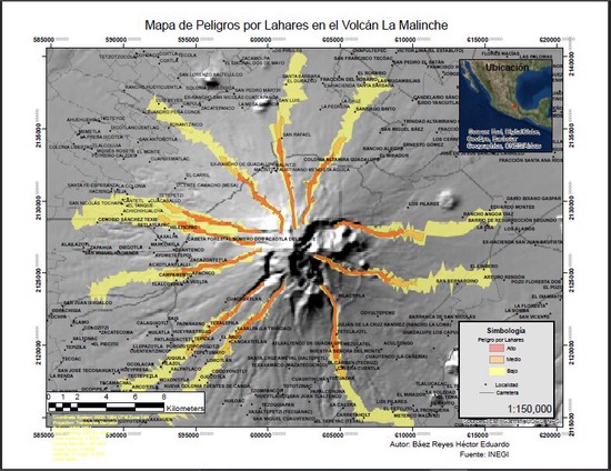
Geographic Information System, 2019
Universidad Nacional Autónoma de México
-
Introduction to the General Transit Feed Specification (GTFS) and Informal Transit System Mapping, 2021
World Bank Group
-
R Programming, 2019
Universidad Nacional Autónoma de México (online course)
-
Python Programming, 2022
Michigan University (online course)
-
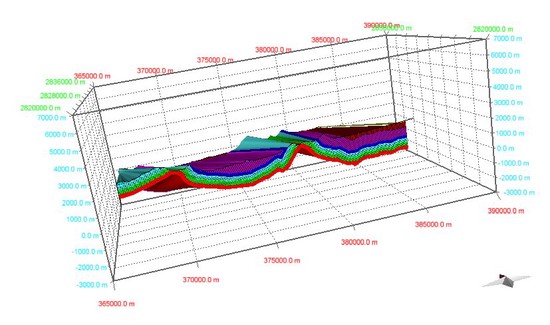
Geoestatistics, 2019
Universidad Nacional Autónoma de México
-
Petrofísica y Registros Geofísicos de Pozo, 2019
Universidad Nacional Autónoma de México
-
Topography, 2015
Universidad Nacional Autónoma de México