Web App for Events Interpolation (Drone Images)
 Drone
Drone
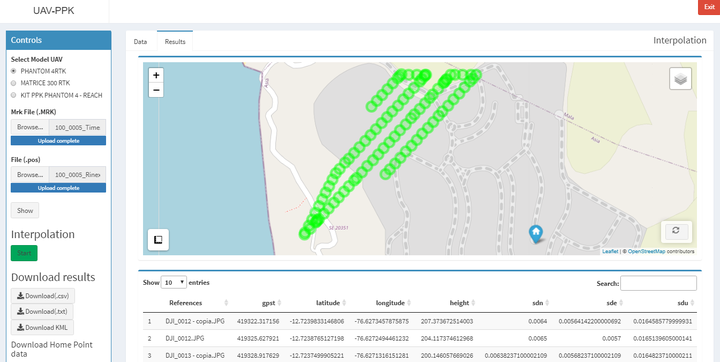
This web app allows you to interpolate events by uploading the corresponding “.mrk” and “.pos” files product of the post-processing kinematic (PPK).
The app currently accepts three different models of inputs (UAV). The main inputs correspond with the files .pos and .mrk and the corresponding Drone images.
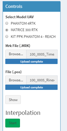
Control Panel
The final product can be downloaded in a .txt format or .kml and it allows a quick quality check of the home point. The app also allows interaction with the final data in an interactive map and a table.
Output results
Héctor Báez
Geologist Engineer
My research focuses on spatial data analysis, GIS, and web development to share knowledge of geospatial data.